Map offline: Green Trails Maps™ No 206S
Map online: TerraServer USA
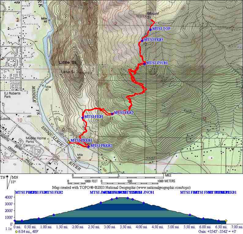
Trailhead coordinate: Lat: 47.486962, Long: -121.754866; Alt: 500 ft.
Elevation gain: 3,667 ft.
Max elevation: Lat: 47.507778, Long: -121.738889; Alt: 4,167 ft.
Hike time: up ↑ 3:00; break ↔ 0:05; down ↓ 1:40; Total ⇅ 4:45
Effort: Hard
Trail difficulty: Difficult


A work associate of mine, Andrei, told me about the Mt. Si old trail. It's steeper than the main trail but ends up at the same place. Jon P and I completed the whole hike in 4:45. It took us 3 hours to get up and the remainder down. Pretty good time for me!


1 comment:
Hi... I also climbed Mt Si years ago.... Took city Buses from Seattle up to North Bend and walked to the base of the mountain and slept... Next Morning I hiked up the trail.... Was an experience I'll always remember.... Was glad to see the pictures and read your blog.... John
Post a Comment