10 mile round trip
Elevation gain: 4,500 ft.
Max elevation: 8,363 ft.
Hike time: up ↑ 3:30; break ↔ 0:50; down ↓ 2:35; Total ⇅ 6:55
Effort: Uneven - Some of us found the rocks difficult, others the ash
Trail difficulty: Most Difficult


I climbed a
freakin' active volcano! All summer I have been building up to this hike. John, Jason, and I met up at Jack's Restaurant where our permits were waiting for us at 9:00am. We got to the trail head by 10:30am to get our early (?) start.
At 8,300 feet, this is by far the highest peak that I've climbed. Given the stats of the hike I didn't expect it to be very difficult; at 5 miles one way, 4,500 feet of ascent, it's not too much more difficult than Granite Mountain at 4 miles and 4,000 feet. However, I learned that this hike is a different beast. There isn't really any trail, just a set of pylons to sight and follow, and the hike gets steeper every step you take. By the top it is very nearly as steep as Mailbox Peak (2.25 miles, 4,000 feet,) but it is all fine ash. Hiking in ash, my friends, is not fun. Try walking up a 25' sand dune 50 times to see what I'm talking about.
The weather was very accommodating considering that initial reports indicated significant likelihood of rain. We didn't see a drop of the stuff. When we got to the top, there were heavy clouds to the North and East. There were less heavy clouds to the South and low clouds to the West. This meant that pictures taken westward show some incredible above the clouds views. Unfortunately, the crater was mostly obscured by the Northward clouds. We did get a brief cloud break to the North allowing us to see the top of Mt. Rainier; brief as it was, it informed me that the heavy clouds to the North were only those held up by the mountain, otherwise we had an over the clouds view to the North too. All in all, I was not disappointed, but I do have a reason to try the climb again.
John and I took a healthy number of pictures. Having combined the sets, you'll actually see a number of pictures of me this time. Enjoy!
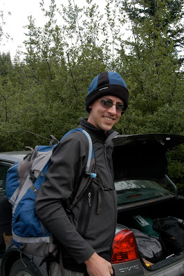 Getting ready at the car. Look at that smile!
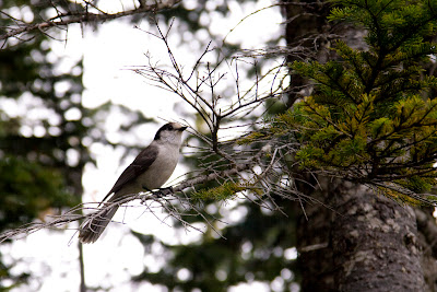 Early on in the trail, we thought the group of birds that this Grey Jay was with may just eat us. There were just too many of them! This bird is interesting as you only see it at altitude. Closer to home, I've seen them at Tiger Mountain.
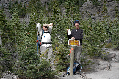 2 miles in at the tree line and 4,800ft. From here on you need a permit. I'm apparently proud of mine.
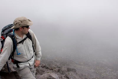 Jason inspecting our progress so far through the clouds.
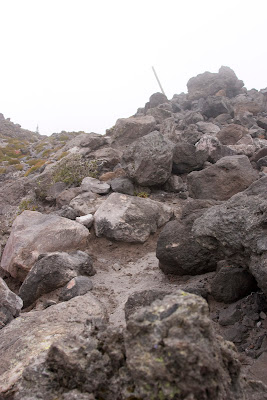 Climb to the next pylon onward and most decidedly upward.
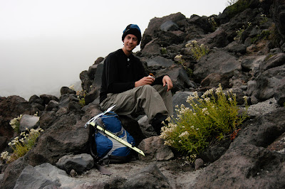 We got a tip from another hiker that there were high winds once we cleared the boulder scramble, so we stopped to have lunch. Only I forgot mine the car. But fear not! I had Combos to cheese my hunger away.
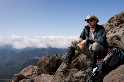 Jason enjoys a cold beer and some jerky.
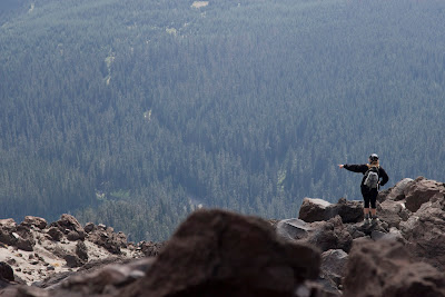 See that tree over there?
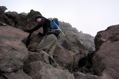 Silly look on my face, but this picture does a good job of showing you what the boulder scramble is like. It really is that steep.
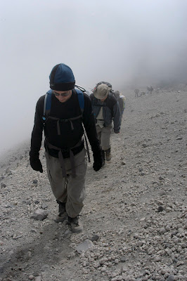 The slog through the sand-dune like last 1200 vertical feet.
 A wisp of a cloud caught in a thermal. We watched these clouds roll in and out in the wind right in front of us. It was really quite spectacular.
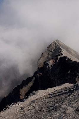 To your right, ash-dune. To you left, abyss. Welcome to the top!
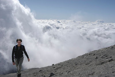 Along the crater, I'm trying to find John. Turns out he was 3 hills away. The crater is really uneven and every time you ascend a hill along it you feel like you've now found the actual peak. We're not even sure which the actual peak was.
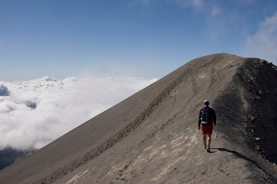 Ah, there he is! Must have been hiding in the clouds. Here he is walking over to one of the "actual peaks."
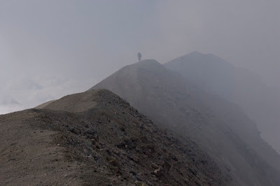 Three of the supposed peaks.
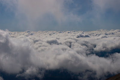 Lots of great views of the clouds up here.
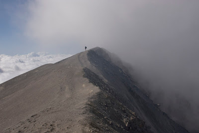 Another crater view among the clouds.
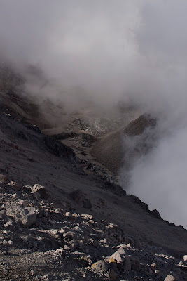 The clouds broke for long enough to see the lava dome. On the left is the crater nearish where we are; in the center you can make out the crater glacier; and on the right is the lava dome; the mountain within the mountain.
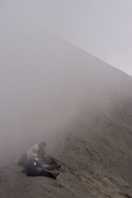 Trying to be artistic.
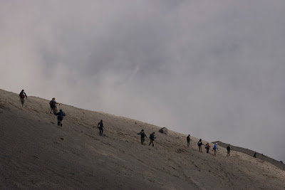 The large party in front of us descending. We'll pass them shortly on the way down.
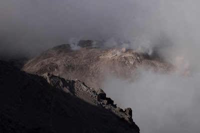 Here's a shot of the lava dome where you can actually see the vents and the steam they're spewing. It smells like sulfur up here!
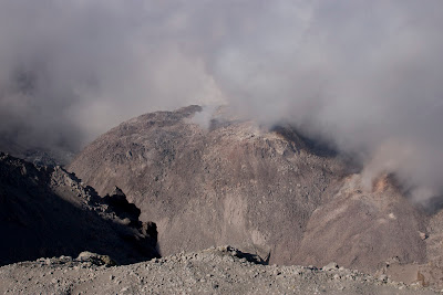 Another of the lava dome.
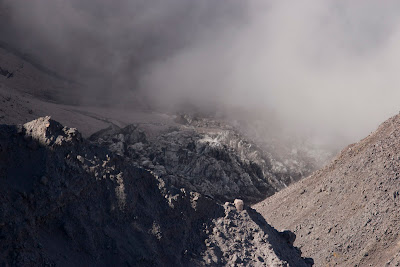 A glacier.
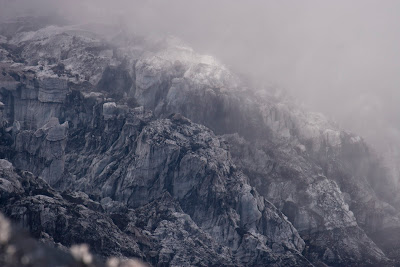 The same glacier close up. Incredible.
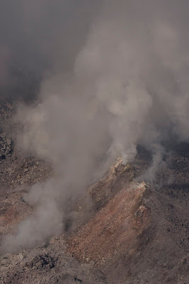 These next few shots are why I carried the heavy lens. :-)
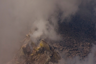 You can see sulfur around the vent.
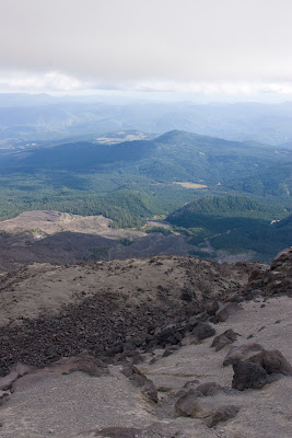 On the way down. From the rocks to the tree line below.
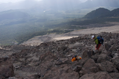 Descending the rocks.
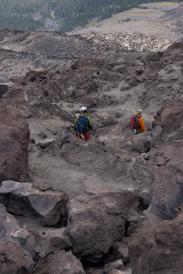 Still descending the rocks.
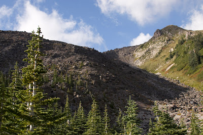 From the tree line back up to the mountain.
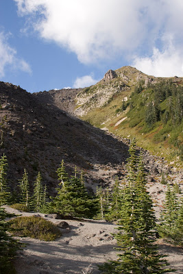 Now that we're all the way down. It's a beautiful day. What a hike!


